 NERC Data Catalogue Service
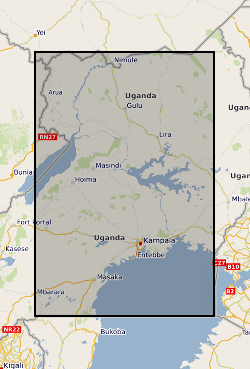
Makerere University
Type of resources
Topics
Keywords
Contact for the resource
Provided by
Years
Formats
Representation types
Update frequencies
-
Revised dataset available here http://data.bgs.ac.uk/id/dataHolding/13607942 .This dataset comprises 655 borehole records and previously unanalysed pumping tests from across Uganda that were compiled from historical borehole records held within 9 district water offices. The dataset is a compilation of historical borehole records held within nine district water offices across Uganda. These data originated from numerous drilling campaigns undertaken by private contractors in each district to site and construct hand-pump borehole community water supplies between 2000 to 2018. In total over 1000 paper borehole records were initially collated and reviewed. This work was carried out over several months visiting the district water offices. Following a quality assurance procedure 655 records were transcribed to create a digital dataset. Each borehole record in the dataset contains a series of metadata alongside the pumping test data (e.g. pump depth, static water level, pumping rate and duration) including locational information (e.g. coordinates, water strike, borehole depth, borehole lithologies). The dataset is delivered as a series georeferenced site information within an MS Excel spreadsheet file.
-
Data comprise modelled flood extents for the Kampala district produced by simulating rainfall events over a 5m Digital Elevation Model (DEM) using a 2D finite-volume hydrodynamic model. The DEM was obtained from Makerere University and rainfall events were sampled across a range of depths and durations (for 20, 40, 60, 80 and 100 mm of rainfall over 1, 3 and 6 hours using flood depth thresholds of 0.1, 0.2 and 0.3 mm). The effects of infiltration were included within green areas based on spatial data obtained from Makerere University. Maximum depths were converted into extents using various thresholds. Full details about this dataset can be found at https://doi.org/10.5285/e53dea2e-cb25-4f0f-b5f9-937eecf15aff
-
Hourly precipitation (mm) recorded at distributed points around Kampala between April 2019 and March 2020. Only timestamps where data were available from all sensors have been included. There are 8094 records in total and no missing values. Timestamps are recorded as “YYYY-MM-DD hh:mm:ss”. The geographic coordinates of the sensors are provided in GeoJSON format. The column names in the CSV file correspond to the “id” field in the GeoJSON file. Full details about this dataset can be found at https://doi.org/10.5285/3df031ad-34ec-4abc-8528-f8f20bad12b8
-

This dataset comprises 655 borehole records and previously unanalysed pumping tests from across Uganda that were compiled from historical borehole records held within 9 district water offices. The dataset is a compilation of historical borehole records held within nine district water offices across Uganda. These data originated from numerous drilling campaigns undertaken by private contractors in each district to site and construct hand-pump borehole community water supplies between 2000 to 2018. In total over 1000 paper borehole records were initially collated and reviewed. This work was carried out over several months visiting the district water offices. Following a quality assurance procedure 655 records were transcribed to create a digital dataset. Each borehole record in the dataset contains a series of metadata alongside the pumping test data (e.g. pump depth, static water level, pumping rate and duration) including locational information (e.g. coordinates, water strike, borehole depth, borehole lithologies). The dataset is delivered as a series georeferenced site information within an MS Excel spreadsheet file.